Current Location: Gallery 32 (Rothschild)
Titles
Portolan Atlas
Maker(s)
Artist:
Agnese, Battista
Entities
Categories
Description
PHYSICAL DESCRIPTION: Parchment, 18 fols. + i original parchment flyleaf pasted down with recessed compass, 255 x 183 mm (ink frame 206 x 320 mm across each opening), variable number of lines, ruled in hardpoint.
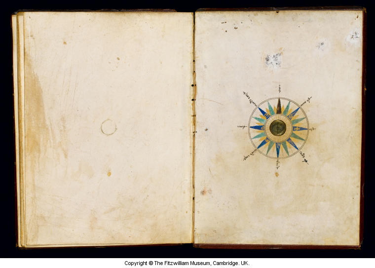
BINDING: Sixteenth century, gold- and blind-tooled red morocco over wooden boards with bevelled edges, sewn on three supports, traces from six clasps (one at top and bottom, two at outer edge), with a compass sunk into the centre of the lower board.
CONTENT:
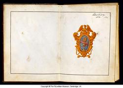
fol. 2r Coat of arms in an ornamental frame
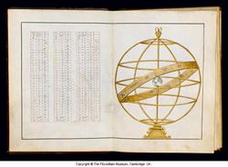
fols. 2v-4r Tables of data and cosmographic measurements
fol. 4v Table of Declinations
fol. 5r Armillary sphere
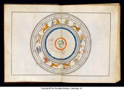
fols. 5v-6r Zodiac as spheres with the earth in the centre
fols. 6v-7r Western section of a three-part world map on plane projection and in portolan style, showing North and South America and the lands of Eastern Asia, with indications of latitude and longitude
fols. 7v-8r Central section of a three-part world map in portolan style showing the east coast of North America, Central and South America, Africa and Europe, with indications of latitude and longitude
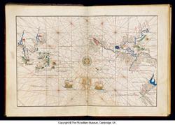
fols. 8v-9r Eastern section of three-part world map in the portolan style showing the Southwest and East coasts of Africa, the Black Sea and Aegean regions, the Arabian peninsula, the Indian subcontinent, and eastern Asia, with indications of latitude and longitude, and wind heads
fols. 9v-10r Land map in the portolan style, showing Northwest and Central Europe.
fols. 10v-11r Portolan chart with some features of a land map, showing Spain and Northwest Africa
fols. 11v-12r Portolan chart showing the Western Mediterranean, including both the European and African coasts
fols. 12v-13r Portolan chart showing the Central Mediterranean, including both the European and African shores
fols. 13v-14r Portolan chart with some features of a land-map showing the Eastern Mediterranean
fols. 14v-15r Portolan chart of the Black Sea with some elements of a land-map and wind heads.
fols. 15v-16r Map showing the Ptolemaic conception of the world (Eastern Hemisphere), not labelled.
fols. 16v-17r Planographic land map of the world, labeled, surrounded by wind heads.
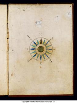
Inside lower cover, recessed compass surrounded by a painted compass rose, labeled in German
DECORATION: Full-page illustration of an armillary sphere in gold (fol. 5r); double-page drawing of the signs of the Zodiac, each painted in colour (fols. 5v-6r); eleven charts with ships at sea, coasts edged in blue with islands picked out in green or gold, rivers drawn in blue, the Red Sea (fols. 8v, 14r) shaded in red, cities painted in red with gold highlighting, mountain ranges coloured in grey and blue, forests in green, wind heads on blue clouds, compass roses drawn in brown ink, with green and red infill, the Tropics and the Equator marked in gold, with direction lines in brown, green and red, and figures of rulers in their lands (fols. 8v-9r, 9v-10r, 10v-11r), some individually named (fols. 9v-10r).
Notes
History note: Made for a member of the Peretti di Montalto family, possibly Felice Peretti di Montalto (1520-1590), later Pope Sixtus V (1585-1590); Richard, seventh Viscount Fitzwilliam of Merrion (1745–1816), acquired in 1814; his bequest, 1816
 IIIF Manifest
